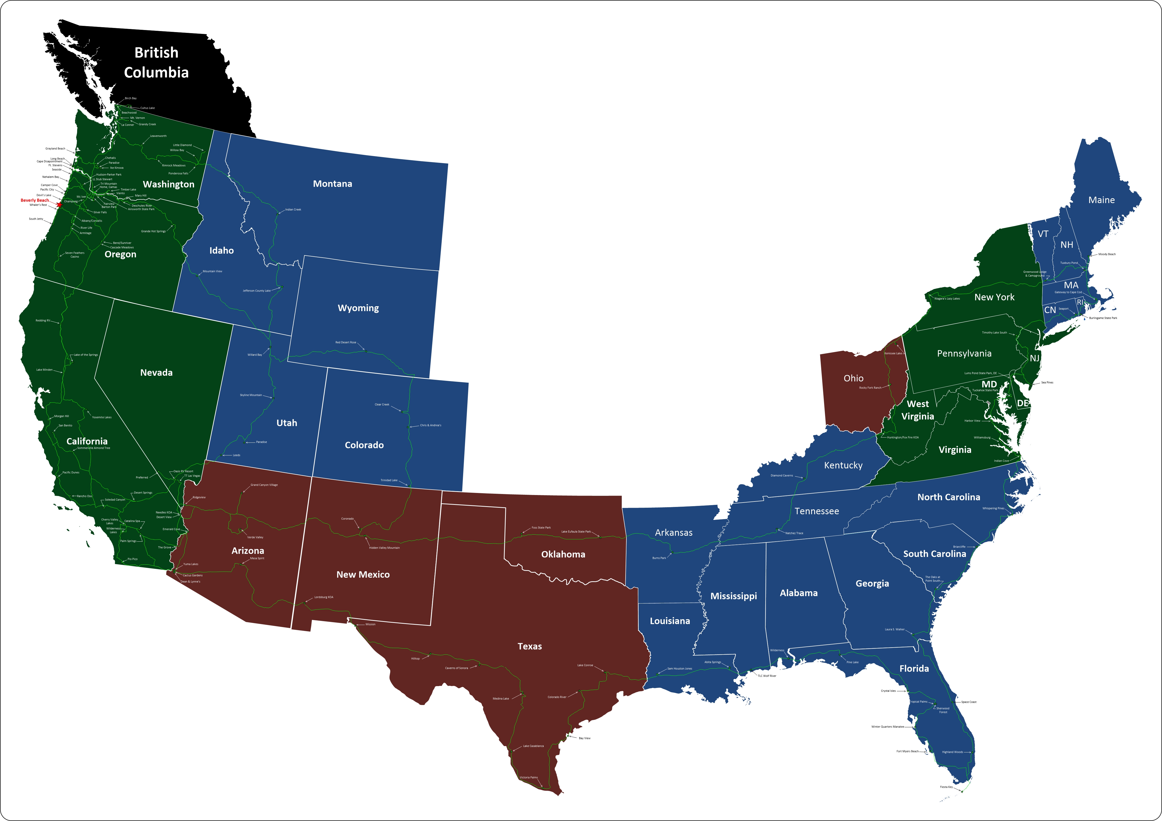
Where We Are Now

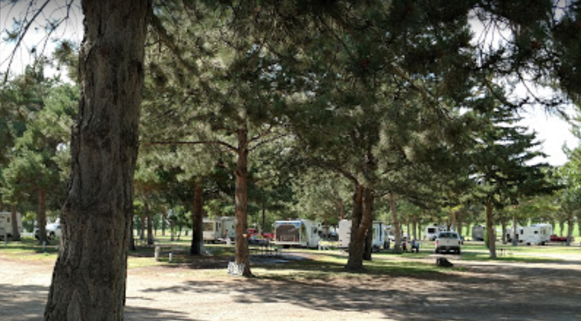
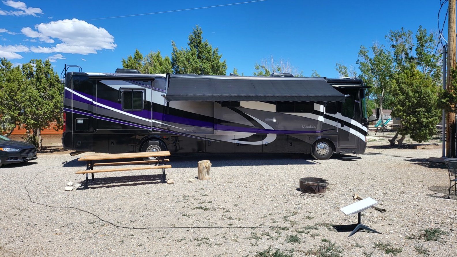
We landed this afternoon at Ely KOA Journey, pretty much right in the middle of Nevada, elevation, 6500 ft. This is just a stop-over for a night, but it really is a nice campground. We plan to drive around this after and check out the town.

   Ely KOA our site

Where We Are on the Map

Where to Next

From here we're heading north to Idaho. Our first stop is a place called Anderson Camp. We plan to spend a couple of days there so we can check out Shoshone Falls and what's left of Twin Falls

 Anderson Camp Stock Photo

Top Panel
Tuesday, 24 December 2024

Screenshot 2022 05 20 click to return

Sam Houston Jones State Park, Lake Charles, LA

Our Visit

      Sam Houston Jones State Park, was just a one night stay over, but after going there, I wish we would have stayed longer. The park is beautiful with swamps and a river, cabins, RV, and tent camping. The campground is wooded with mostly paved sites.

Read More

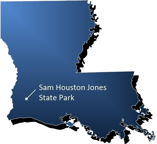
Sam Houston on the map blue burned

Most are a bit tight for bigger rigs, but we managed to fit. Walking around the park we saw that the swamp directly across from the campground had been drained. (to restore some of the forests)  As we followed the road we found a large picnic area with plenty of tables along the river bank. There is a boat ramp and we saw someone out in a kayak paddling up and down the river. There is a boat ramp with a warning sign not to swim and a possibility of alligators. Further along, the road was several very nice cabins to rent. There was a second swamp, this one not drained with a large wooden bridge crossing it. In the middle of the bridge was an amphitheater. From the bridge looking down into the swamp, we saw dozens of turtles swimming about. (I took pictures, but you need to zoom in to see their heads poking out of the water and their bodies under the surface) As we passed the cabins along our walk around the park we discovered a full 18-hole disc golf course. Had we more time, we would have grabbed our discs and tried it out. Alongside the road, we could see that water had recently receded from there and discovered what we later found to be mounds of mud with holes in them made by crawfish digging into the ground as the water evaporated. Being from the Northwest, this was new. Later we searched You-tube and watched a video of someone pushing his arm (up to his shoulder) in a hole and pulling out a crawfish. A second video showed him using a trap in a creek using dry dog food as bait and catching them by the dozen.

     Overall, we really liked the park, we met some great people there and would recommend two nights if you’re using it as a stopover on your way down the road.

Campground number eighty-six. 

  • April 18, 2018 -  1 day
  1. Campground Information
  2. Their Description
  3. Amenities
  4. Policies .
Website:
  crt.state.la.us
Type: State Park
Address: Sam Houston Jones State Park, 
       107 Sutherland Rd,
        Lake Charles, LA 70611
Phone: (337) 855-2665

Originally named for the Texas folk hero who traveled extensively in the western reaches of Louisiana, Sam Houston Jones was given its current name in honor of the state's 46th governor, who was instrumental in setting aside this tract of land for the public to enjoy for both day-use and overnight visitors.
Because the caretakers of this 1,087-acre park have worked to keep the land in its natural state, abundant wildlife inhabits the area. Tree-filled lagoons and mixed pine and hardwood forest combine to create a unique natural environment. The park is located just north of the most productive birding region of Louisiana. The bird watching is always excellent, but at certain times of the year, nearly 200 species of birds can be seen at or within 30 miles of the site.

The Office of State Parks has partnered with Sasol in Lake Charles on the Longleaf Legacy Project,  to preserve the iconic tree's rich history, restore the splendor of local forests, and ensure the resiliency of such habitats for generations to come.  The project includes the restoration of over 70 acres of longleaf forest in the park and companion educational programs for local teachers and families.

Sam Houston Jones State Park is home to more than 70 acres of longleaf pines, the oldest living southern pine species. They were once one of the most abundant tree species in the United States, stretching across 90 million acres from Virginia to Texas. Over time, land-use practices such as logging, farming, development, urban encroachment, and fire exclusion have diminished the longleaf pine, leaving less than 4 million acres of longleaf forest and less than 10 percent of their original presence in Louisiana.

The numerous waterways in this area make water sports a natural highlight at the park. Two boat launches are conveniently located on the West Fork of the Calcasieu River, providing access to Calcasieu Lake, about 20 miles away. (No-Wake Zone Advisory )

The three hiking trails winding through this beautiful park make strolling or serious hiking, pleasurable. Particularly interesting is the old stagecoach road, which hikers may travel to explore the park and the banks of the various tributaries to the Calcasieu River.


 Day Use Fee Symbol burnedOpen Year Round Symbol burned30 amp Symbol burned50 amp Symbol burnedWater Symbol burnedCampfire Symbol burnedTenting Symbol burnedCabin Symbol burnedHandicap Symbol burnedHiker Biker Camp Symbol burnedRestroom Symbol burnedShower Symbol 3 burnedPicnic Area Symbol burnedPicnic Shelter Symbol burnedPlayground Symbol burnedDump Station Symbol burnedPets Symbol burnedFirewood Symbol burnedHiking Symbol burnedBike Path Symbol burnedBird Watching Symbol burnedWildlife Viewing Symbol burnedScenic Views Symbol burnedDisc Golf Symbol burnedFishing Symbol burnedBoat Ramp Symbol burnedBoating Symbol burnedPaddling Symbol burnedKayaking Symbol burnedBeach Access Symbol burned

Hours of Operation:
Site is open daily.

Gate Opening Times:
Sunday through Thursday

  • open at 6 a.m.
  • close at 9 p.m.

Friday, Saturday and days preceding holidays.

  • open at 6 a.m.
  • close at 10 p.m.

Entrance Station Hours:
Sunday through Thursday

  • 8 a.m. to 5 p.m.

Friday, Saturday and days preceding holidays.

  • 8 a.m. to 10 p.m.

Entrance Fees

  • $3 per person
  • Free for seniors (62 & older)
  • Free for children (3 & under)

Camping
A $6 non-refundable fee will be assessed on each reservation transaction made online, via phone, or as a walk-in.
map of sites 23-43)  ( map of sites 44-62)

9 Premium Campsites (pull-through sites with water and electrical hookups) $33/night plus tax, Fri-Sat
$30/night plus tax, Sun-Thurs, Apr-Sept
$25/night plus tax, Sun-Thurs, Oct-Mar
26 Improved Campsites (water and electrical hookup) $28/night plus tax, Fri-Sat
$25/night plus tax, Sun-Thurs, Apr-Sept
$20/night plus tax, Sun-Thurs, Oct-Mar
Backcountry campsites (maximum capacity of 6), 5 available on a first-come, first-served basis $9 per person/night, plus tax
Primitive camping area (maximum capacity of 20) $20/night plus tax
America the Beautiful Senior and Access Passes (formerly Golden Age & Golden Access Passports) (Available through the National Park Service. Click here for more information)
Holders of the Passes, whose state of residence also honors the America the Beautiful pass, are entitled to a 50% reduction on camping fees at Louisiana State Parks. (Passport holders are allowed one site per passport).

Additional Information About Overnight Facilities
Rick

Rick

Wednesday, 22 May 2019 03:51

Florida

Florida

From Wikipedia

Florida is the southernmost contiguous state in the United States. The state is bordered to the west by the Gulf of Mexico, to the northwest by Alabama, to the north by Georgia, to the east by the Atlantic Ocean, and to the south by the Straits of Florida. Florida is the 22nd-most extensive (65,755 sq mi or 170,300 km2), the 3rd-most populous (21,312,211 inhabitants), and the 8th-most densely populated (384.3/sq mi or 148.4/km2) of the U.S. states. Jacksonville is the most populous municipality in the state and the largest city by area in the contiguous United States. The Miami metropolitan area is Florida's most populous urban area. Tallahassee is the state's capital.

Tuesday, 21 May 2019 23:09

Arkansas

Arkansas

From Wikipedia

Arkansas is a state in the southern region of the United States, home to over 3 million people as of 2018. Its name is of Siouan derivation from the language of the Osage denoting their related kin, the Quapaw Indians. The state's diverse geography ranges from the mountainous regions of the Ozark and the Ouachita Mountains, which make up the U.S. Interior Highlands, to the densely forested land in the south known as the Arkansas Timberlands, to the eastern lowlands along the Mississippi River and the Arkansas Delta.

Tuesday, 21 May 2019 23:05

Alabama

Alabama

From Wikipedia

Alabama is a state in the southeastern region of the United States. It is bordered by Tennessee to the north, Georgia to the east, Florida and the Gulf of Mexico to the south, and Mississippi to the west. Alabama is the 30th largest by area and the 24th-most populous of the U.S. states. With a total of 1,500 miles (2,400 km) of inland waterways, Alabama has among the most of any state.

Tuesday, 21 May 2019 23:02

Texas

Texas

From Wikipedia

Texas is the second largest state in the United States by both area and population. Geographically located in the South Central region of the country, Texas shares borders with the U.S. states of Louisiana to the east, Arkansas to the northeast, Oklahoma to the north, New Mexico to the west, and the Mexican states of Chihuahua, Coahuila, Nuevo León, and Tamaulipas to the southwest, and has a coastline with the Gulf of Mexico to the southeast.

Tuesday, 21 May 2019 22:58

Oklahoma

Oklahoma

From Wikipedia

Oklahoma is a state in the South Central region of the United States, bordered by Kansas on the north, Missouri on the northeast, Arkansas on the east, Texas on the south, New Mexico on the west, and Colorado on the northwest. It is the 20th-most extensive and the 28th-most populous of the fifty United States. The state's name is derived from the Choctaw words okla and humma, meaning "red people". It is also known informally by its nickname, "The Sooner State", in reference to the non-Native settlers who staked their claims on land before the official opening date of lands in the western Oklahoma Territory or before the Indian Appropriations Act of 1889, which dramatically increased European-American settlement in the eastern Indian Territory. Oklahoma Territory and Indian Territory were merged into the State of Oklahoma when it became the 46th state to enter the union on November 16, 1907. Its residents are known as Oklahomans (or colloquially, "Okies"), and its capital and largest city is Oklahoma City.

Tuesday, 21 May 2019 22:54

New Mexico

New Mexico

From Wikipedia

New Mexico is a state in the Southwestern region of the United States of America; its capital and cultural center is Santa Fe, which was founded in 1610 as capital of Nuevo México (itself established as a province of New Spain in 1598), while its largest city is Albuquerque with its accompanying metropolitan area. It is one of the Mountain States and shares the Four Corners region with Utah, Colorado, and Arizona; its other neighboring states are Oklahoma to the northeast, Texas to the east-southeast, and the Mexican states of Chihuahua to the south and Sonora to the southwest. With a population around two million, New Mexico is the 36th state by population. With a total area of 121,592 sq mi (314,920 km2), it is the fifth-largest and sixth-least densely populated of the 50 states. Due to their geographic locations, northern and eastern New Mexico exhibit a colder, alpine climate, while western and southern New Mexico exhibit a warmer, arid climate.

Tuesday, 21 May 2019 22:40

Arizona

Arizona

From Wikipedia

Arizona is a state in the southwestern region of the United States. It is also part of the Western and the Mountain states. It is the sixth largest and the 14th most populous of the 50 states. Its capital and largest city is Phoenix. Arizona shares the Four Corners region with Utah, Colorado, and New Mexico; its other neighboring states are Nevada and California to the west and the Mexican states of Sonora and Baja California to the south and southwest.

Tuesday, 21 May 2019 22:35

Vermont

Vermont

From Wikipedia

Vermont is a state in the New England region of the northeastern United States. It borders the U.S. states of Massachusetts to the south, New Hampshire to the east, New York to the west, and the Canadian province of Quebec to the north. Vermont is the second-smallest by population and the sixth-smallest by area of the 50 U.S. states. The state capital is Montpelier, the least populous state capital in the United States. The most populous city, Burlington, is the least populous city to be the most populous city in a state. As of 2015, Vermont was the leading producer of maple syrup in the United States. In crime statistics, it was ranked since 2016 as the safest state in the country.

Tuesday, 21 May 2019 17:32

Rhode Island

Rhode Island

From Wikipedia

Rhode Island, officially the State of Rhode Island and Providence Plantations, is a state in the New England region of the United States. It is the smallest state in area, the seventh least populous, the second most densely populated, and it has the longest official name of any state. Rhode Island is bordered by Connecticut to the west, Massachusetts to the north and east, and the Atlantic Ocean to the south via Rhode Island Sound and Block Island Sound. It also shares a small maritime border with New York. Providence is the state capital and most populous city in Rhode Island.

Tuesday, 21 May 2019 17:28

New Hampshire

New Hampshire

From Wikipedia

New Hampshire is a state in the New England region of the northeastern United States. It is bordered by Massachusetts to the south, Vermont to the west, Maine and the Atlantic Ocean to the east, and the Canadian province of Quebec to the north. New Hampshire is the 5th smallest by area and the 10th least populous of the 50 states. Concord is the state capital, while Manchester is the largest city in the state. It has no general sales tax, nor is personal income (other than interest and dividends) taxed at either the state or local level. The New Hampshire primary is the first primary in the U.S. presidential election cycle. Its license plates carry the state motto, "Live Free or Die". The state's nickname, "The Granite State", refers to its extensive granite formations and quarries.

Campground Menu


Our Route

Travels 05 08 19 fast Click on map for a larger, slower view.


Our Travels

5 31 19 mappClick on map for a larger view.