Where We Are Now

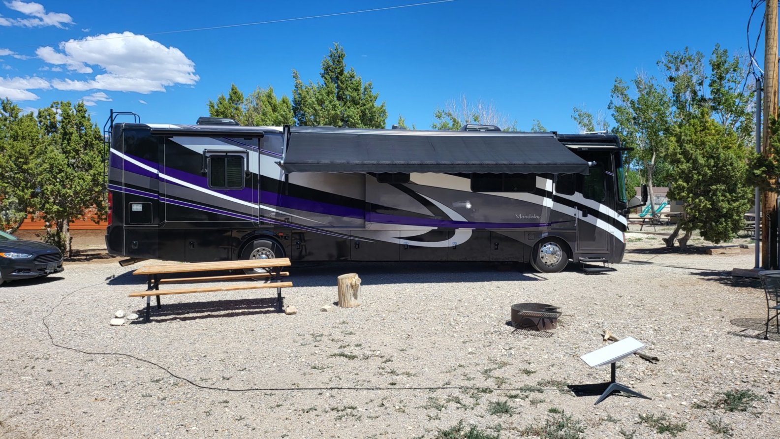
We landed this afternoon at Ely KOA Journey, pretty much right in the middle of Nevada, elevation, 6500 ft. This is just a stop-over for a night, but it really is a nice campground. We plan to drive around this after and check out the town.

   Ely KOA our site

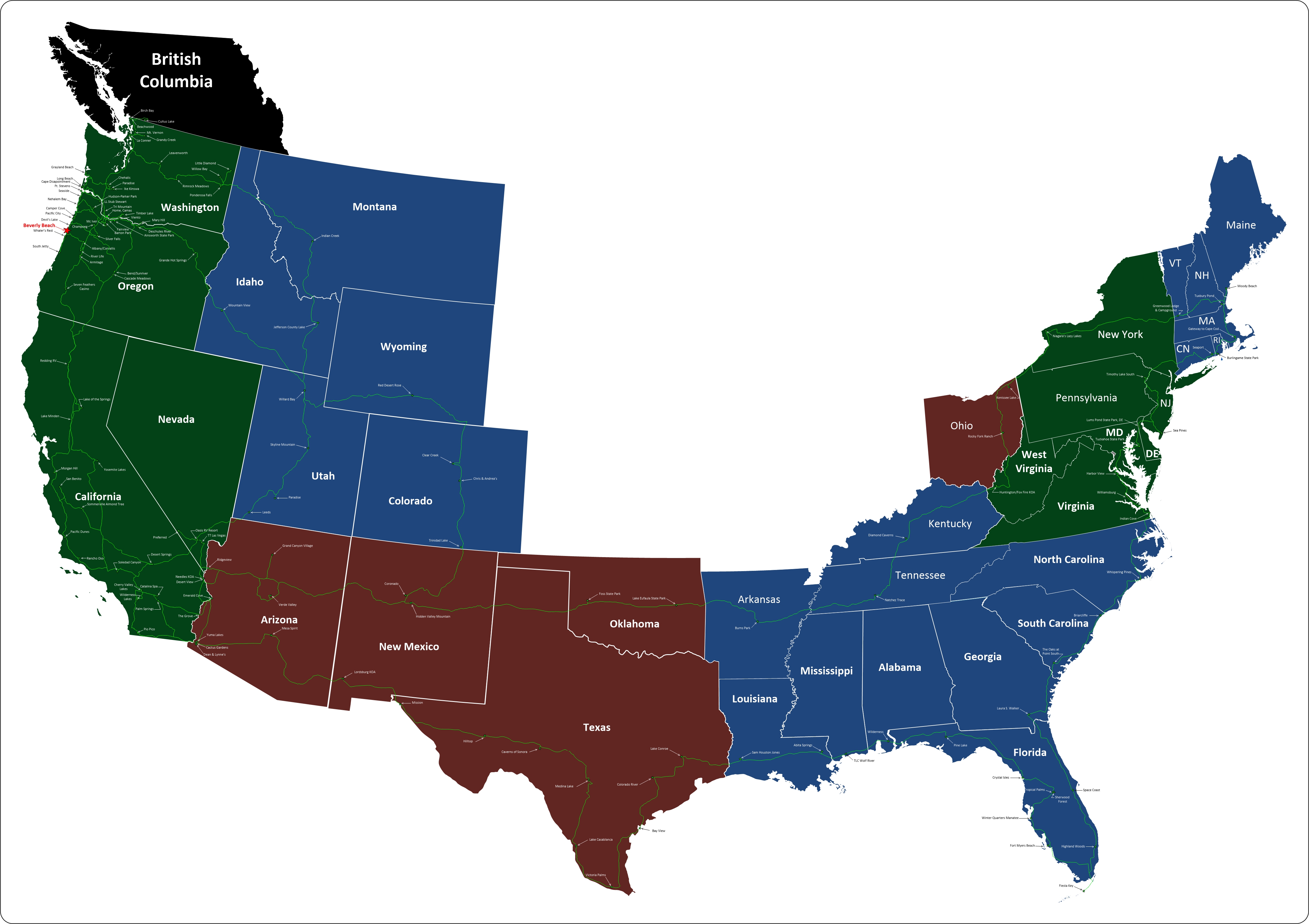
Where We Are on the Map

Where to Next

From here we're heading north to Idaho. Our first stop is a place called Anderson Camp. We plan to spend a couple of days there so we can check out Shoshone Falls and what's left of Twin Falls

 Anderson Camp Stock Photo

Top Panel
Sunday, 24 November 2024

Screenshot 2022 05 20 click to return

Rick

Rick

Tuesday, 21 May 2019 17:24

Massachusetts

Massachusetts

From Wikipedia

Massachusetts, officially the Commonwealth of Massachusetts, is the most populous state in the New England region of the northeastern United States. It borders on the Atlantic Ocean to the east, the states of Connecticut and Rhode Island to the south, New Hampshire and Vermont to the north, and New York to the west. The state is named after the Massachusett tribe, which once inhabited the east side of the area, and is one of the original thirteen states. The capital of Massachusetts is Boston, which is also the most populous city in New England. Over 80% of Massachusetts's population lives in the Greater Boston metropolitan area, a region influential upon American history, academia, and industry. Originally dependent on agriculture, fishing and trade, Massachusetts was transformed into a manufacturing center during the Industrial Revolution. During the 20th century, Massachusetts's economy shifted from manufacturing to services.] Modern Massachusetts is a global leader in biotechnology, engineering, higher education, finance, and maritime trade.

Tuesday, 21 May 2019 17:18

Maine

Maine

From Wikipedia

Maine is a state in the New England region of the northeastern United States. Maine is the 12th smallest by area, the 9th least populous, and the 38th most densely populated of the 50 U.S. states. It is bordered by New Hampshire to the west, the Atlantic Ocean to the southeast, and the Canadian provinces of New Brunswick and Quebec to the northeast and northwest respectively. Maine is the easternmost state in the contiguous United States, and the northernmost state east of the Great Lakes. It is known for its jagged, rocky coastline; low, rolling mountains; heavily forested interior; and picturesque waterways, as well as its seafood cuisine, especially lobster and clams. There is a humid continental climate throughout most of the state, including in coastal areas such as its most populous city of Portland. The capital is Augusta.

Tuesday, 21 May 2019 16:04

Connecticut

Connecticut

From Wikipedia

Connecticut is the southernmost state in the New England region of the United States. As of the 2010 Census, it has the highest per-capita income, Human Development Index (0.962), and median household income in the United States. It is bordered by Rhode Island to the east, Massachusetts to the north, New York to the west, and Long Island Sound to the south. Its capital is Hartford and its most populous city is Bridgeport. It is part of New England, although portions of it are often grouped with New York and New Jersey as the Tri-state area. The state is named for the Connecticut River which approximately bisects the state. The word "Connecticut" is derived from various anglicized spellings of an Algonquian word for "long tidal river".

Tuesday, 21 May 2019 15:58

West Virginia

West Virginia

From Wikipedia

West Virginia is a state located in the Appalachian region in the Southern United States, and is also considered to be a part of the Middle Atlantic States. It is bordered by Pennsylvania to the north, Maryland to the east and northeast, Virginia to the southeast, Kentucky to the southwest, and Ohio to the northwest. West Virginia is the 41st largest state by area, and is ranked 38th in population. The capital and largest city is Charleston.

Tuesday, 21 May 2019 15:55

Virginia

Virginia

From Wikipedia

Virginia, officially the Commonwealth of Virginia, is a state in the Southeastern and Mid-Atlantic[6] regions of the United States located between the Atlantic Coast and the Appalachian Mountains. The geography and climate of the Commonwealth are shaped by the Blue Ridge Mountains and the Chesapeake Bay, which provide habitat for much of its flora and fauna. The capital of the Commonwealth is Richmond; Virginia Beach is the most populous city, and Fairfax County is the most populous political subdivision. The Commonwealth's estimated population as of 2018 is over 8.5 million.

The area's history begins with several indigenous groups, including the Powhatan. In 1607 the London Company established the Colony of Virginia as the first permanent New World English colony. Virginia's state nickname, the Old Dominion, is a reference to this status. Slave labor and the land acquired from displaced Native American tribes each played a significant role in the colony's early politics and plantation economy. Virginia was one of the 13 Colonies in the American Revolution. In the American Civil War, Virginia's Secession Convention resolved to join the Confederacy, and Virginia's First Wheeling Convention resolved to remain in the Union; that led to the creation of West Virginia. Although the Commonwealth was under one-party rule for nearly a century following Reconstruction, both major national parties are competitive in modern Virginia.

The Virginia General Assembly is the oldest continuous law-making body in the New World. The state government was ranked most effective by the Pew Center on the States in both 2005 and 2008. It is unique in how it treats cities and counties equally, manages local roads, and prohibits its governors from serving consecutive terms. Virginia's economy has many sectors: agriculture in the Shenandoah Valley; federal agencies in Northern Virginia, including the headquarters of the U.S. Department of Defense and Central Intelligence Agency (CIA); and military facilities in Hampton Roads, the site of the region's main seaport.

Tuesday, 21 May 2019 15:51

Pennsylvania

Pennsylvania

From Wikipedia

Pennsylvania, officially the Commonwealth of Pennsylvania, is a state located in the northeastern, Great Lakes and Mid-Atlantic regions of the United States. The Appalachian Mountains run through its middle. The Commonwealth is bordered by Delaware to the southeast, Maryland to the south, West Virginia to the southwest, Ohio to the west, Lake Erie and the Canadian province of Ontario to the northwest, New York to the north, and New Jersey to the east.

Tuesday, 21 May 2019 15:20

New York

New York

From Wikipedia

New York is a state in the Northeastern United States. New York was one of the original thirteen colonies that formed the United States. With an estimated 19.54 million residents in 2018, it is the fourth most populous state. In order to distinguish the state from the city with the same name, it is sometimes referred to as New York State.

Tuesday, 21 May 2019 15:10

New Jersey

New Jersey

From Wikipedia

New Jersey is a state in the Mid-Atlantic region of the United States. It is a peninsula, bordered on the north and east by the state of New York; on the east, southeast, and south by the Atlantic Ocean; on the west by the Delaware River and Pennsylvania; and on the southwest by the Delaware Bay and Delaware. New Jersey is the fourth-smallest state by area but the 11th-most populous, with 9 million residents as of 2017, making it the most densely populated of the 50 U.S. states with its biggest city being Newark. New Jersey lies completely within the combined statistical areas of New York City and Philadelphia. New Jersey was the second-wealthiest U.S. state by median household income as of 2017.

Tuesday, 21 May 2019 15:05

Maryland

Maryland

From Wikipedia

Maryland is a state in the Mid-Atlantic region of the United States, bordering Virginia, West Virginia, and the District of Columbia to its south and west; Pennsylvania to its north; and Delaware to its east. The state's largest city is Baltimore, and its capital is Annapolis. Among its occasional nicknames are Old Line State, the Free State, and the Chesapeake Bay State. It is named after the English queen Henrietta Maria, known in England as Queen Mary.

Sixteen of Maryland's twenty-three counties, as well as the city of Baltimore, border the tidal waters of the Chesapeake Bay estuary and its many tributaries, which combined total more than 4,000 miles of shoreline. Although one of the smallest states in the U.S., it features a variety of climates and topographical features that have earned it the moniker of America in Miniature. In a similar vein, Maryland's geography, culture, and history combines elements of the Mid-Atlantic, Northeastern, and South Atlantic regions of the country.

One of the original Thirteen Colonies of Great Britain, Maryland was founded by George Calvert, a Catholic convert who sought to provide a religious haven for Catholics persecuted in England. In 1632, Charles I of England granted Calvert a colonial charter, naming the colony after his wife, Queen Mary. Unlike the Pilgrims and Puritans, who enforced religious conformity in their settlements, Calvert envisioned a colony where people of different religious sects would coexist under the principle of toleration. Accordingly, in 1649 the Maryland General Assembly passed an Act Concerning Religion, which enshrined this principle by penalizing anyone who "reproached" a fellow Marylander based on religious affiliation. Nevertheless, religious strife was common in the early years, and Catholics remained a minority, albeit in greater numbers than in any other English colony.

Maryland's early settlements and population centers clustered around rivers and other waterways that empty into the Chesapeake Bay. Its economy was heavily plantation-based, centered mostly on the cultivation of tobacco. The need for cheap labor led to a rapid expansion of indentured servants, penal labor, and African slaves. In 1760, Maryland's current boundaries took form following the settlement of a long-running border dispute with Pennsylvania. Maryland was an active participant in the events leading up to the American Revolution, and by 1776 its delegates signed the Declaration of Independence. Many of its citizens subsequently played key political and military roles in the war. In 1790, the state ceded land for the establishment of the U.S. capital of Washington, D.C.

Although a slave state, Maryland remained in the Union during the U.S. Civil War, its strategic location giving it a significant role in the conflict. After the war, Maryland took part in the Industrial Revolution, driven by its seaports, railroad networks, and mass immigration from Europe. Since the Second World War, the state's population has grown rapidly, to approximately six million residents, and it is among the most densely populated states in the nation. As of 2015, Maryland had the highest median household income of any state, owing in large part to its close proximity to Washington, D.C. and a highly diversified economy spanning manufacturing, services, higher education, and biotechnology. Maryland has been ranked as one of the best governed states in the country. The state's central role in American history is reflected by its hosting of some of the highest numbers of historic landmarks per capita.
Tuesday, 21 May 2019 14:53

Delaware

Delaware

From Wikipedia

Delaware is one of the 50 states of the United States, in the South-Atlantic or Southern region.[a] It is bordered to the south and west by Maryland, north by Pennsylvania, and east by New Jersey and the Atlantic Ocean. The state takes its name from Thomas West, 3rd Baron De La Warr, an English nobleman and Virginia's first colonial governor.

Delaware occupies the northeastern portion of the Delmarva Peninsula. It's the second smallest and sixth least populous state, but the sixth most densely populated. Delaware's largest city is Wilmington. The state is divided into three counties, the lowest number of any state. From north to south, they are New Castle County, Kent County, and Sussex County. While the southern two counties have historically been predominantly agricultural, New Castle County is more industrialized.

Before its coastline was explored by Europeans in the 16th century, Delaware was inhabited by several groups of Native Americans, including the Lenape in the north and Nanticoke in the south. It was initially colonized by Dutch traders at Zwaanendael, near the present town of Lewes, in 1631. Delaware was one of the 13 colonies participating in the American Revolution. On December 7, 1787, Delaware became the first state to ratify the Constitution of the United States, and has since been known as "The First State".

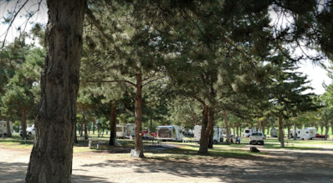
Seaport Google Map

Las Vegas Oasis Google Map


Our Route

Travels 05 08 19 fast Click on map for a larger, slower view.


Our Travels

5 31 19 mappClick on map for a larger view.